Search This Blog

Tuesday, 6 February 2018

Hadrian’s Wall Path National Trail: Portgate to Heavenfield, walking west.

The stile to take you onto the trail is in the car park of The Errington Arms Public House. Once over the stile the trail follows a slight incline as it passes through grassland. It is three and a quarter miles to Heavenfield.


Information plaque


Stile at start of section

You will be walking with the Vallum on your left and you will need to go over another stile. The trail continues to follow a slight incline until you meet a narrow road.

Trail beside the Vallum

Two stiles with a newly installed gate negotiate this road crossing and you will find yourself with the Vallum still on your left and in continuing grassland.


View of the Vallum

The trail is still following the slight incline and the Military Road (B6318) will be on your right.

You will be coming to the site of Milecastle 23 - Ordnance Survey: NY975 689. The trail levels out as you near Milecastle 23.

Site of Milecastle 23

You will pass the site of Milecastle 23, on your right and enter Stanley Plantation through the gate. Much of the plantation of trees has been felled.


Gate into Stanley Plantation

The trail is close to the Military Road as you pass through the now open ground. The trail is on level ground as you reach the highest point of the section 268 metres above sea level – Ordnance Survey: NY973 690.  The trail then goes downhill until you exit the woodland.

Triangulation pillar

Trail in Stanley Plantation


As you leave Stanley Plantation you will cross a Drove road and continue on a level section with stone flags in some places, the Military Road Plantation on your left.


Approaching stone-flagged area of Trail

At the end of this part of the trail there are two stiles to negotiate the road crossing. Once over the road, the Vallum will be on your left and on your right there is evidence of stone quarrying.

Evidence of stone quarrying

After a slight incline the trail carries on through rough pasture and levels out through an area of gorse bushes. Another stile takes you into grassland and the site of Milecastle 24 – Ordnance Survey: NY960 692 is on your right.

Site of Milecastle 24

Passing Milecasle 24, it is a short walk to the stone stiles which are used to cross the Military Road. Care should be taken whilst crossing this very busy road.

Stone stile


Stone stile

The Military Road will now be on your left as you go down a set of stone steps to get back on the trail which continues in grassland. The Wall ditch can easily be seen on your left, as you continue on your walk.

Wall ditch beside the Trail


Well defined section of Wall ditch

The trail continues until you reach another stile, once over the path follows a short incline, the trail then follows level ground, until you reach another stile underneath the low branches of a tree.

Approaching slight incline

Once over this stile you will walk down a gradual slope through grassland and go through a single gate. The ditch will now be on your right hand side as you approach St. Oswald’s Hill Head Farm.

Wall ditch approaching St. Oswald's Hill Head Farm

Two further gates have to be negotiated before you walk up a set of steps at St. Oswald’s Hill Head Farm. The Tea Room has now been converted into a holiday cottage 
and will be on your right.


Approaching steps at St. Oswald's Hill Head Farm

St. Oswald's Hill Head Farm


The Military Road will be on your left as you walk towards the gate into Heavenfield. The path runs through grassland and in the middle of the field on your right you will see St.Oswald’s Church.

Gate into Heavenfield

Heavenfield


St. Oswald's Church

The lay by at Heavenfield marks the end of this section of the trail.

Lay by at Heavenfield

Fingerpost at Heavenfield

Thursday, 21 July 2016

A face in a picture - A link to Hadrian's Wall

Visitors to Wallington Hall http://www.nationaltrust.org.uk/wallington now follow a new route, for those who have never been in the property before; they are minutes away from seeing something rather special.

In no time at all, they come to an impressive part of the building – the Central Hall. The paintings of William Bell Scott are always guaranteed to make the visitor linger and ask questions. Out of all the eight paintings that illustrate Northumbria’s history with life size figures, there is one face in the collection that will always be linked to specific parts of Hadrian’s Wall.


‘The Romans cause a Wall to be built for the protection of the South’.

The face painted by William Bell Scott, is  that of John Clayton. He is depicted as a  Centurion directing construction of part of Hadrian’s Wall. What role did he play?

John Clayton (10 June 1792 – 14 July 1890) was an antiquarian and town clerk of Newcastle upon Tyne. During the nineteenth century, he worked with the builder Richard Grainger and architect John Dobson to redevelop the centre of the city in a neoclassical style, and Clayton Street in Newcastle is named after him.

Conservation of certain parts of Hadrian's Wall can be attributed mainly to this single man, who felt the wall was worth preserving.

He first became interested in Hadrian’s Wall whilst staying at the family’s country home at Chesters. What he saw, during his time there horrified him – local farmers were using the stone from the wall and he was powerless to stop them. In a bid to prevent the farmers using stone for their building projects, he started a programme of buying up the farms and surrounding land.

In the 1830s, John Clayton bought up as much of the land containing the wall remains as he could. On his own, he began to excavate the ruins and oversee reconstruction of portions of the wall. The techniques that were used have allowed the reconstructed sections of the wall to remain in the condition we find it today.

He started by buying property around Steel Rigg and he finally gained control of land from Acomb Fell near Brunton in the east to Cawfields in the west. His land was to include some of the most important sites associated with Hadrian’s Wall: Chesters, Carrawburgh, Housesteads and Vindolanda.

 Clayton’s enthusiasm helped preserve the central stretch of Hadrian’s Wall which is now part of a UNESCO[1] World Heritage Site and a well maintained National Trail.

The best examples of the ‘Clayton Wall’ are to be found at Housesteads, and this forms the memorable central section of the National Trail.


The 84 mile National Trail takes about 10,000 walkers every year along the riverside route in Tyneside, through farmland in Tynedale onto the grazing upland section dominated by the Whin Sill enscarpment of the Central section. It then gradually descends to the rich pastures of Cumbria and finally the salt marsh of the Solway Estuary. The walkers come from all around the country and from around the World, some to complete the whole trail in one go, others to complete small sections and those on a day out in the area.

Just as first time visitors marvel at the paintings and architecture of the Central Hall, walkers on the Hadrian’s Wall National Trail marvel at the different types of countryside they will pass through, the scenery and the legacy left by the work of John Clayton. The task of managing the unique fabric of the site, trail and adjacent corridor, coast to coast has been passed to Northumberland National Park. [2]


The identified painting at Wallington Hall is a fitting memorial to a man who did and gave so much to our area during his lifetime. John Clayton has his face in a painting at Wallington Hall – a link to Hadrian’s Wall! http://hadrianswallcountry.co.uk/


[1] United Nations Educational, Scientific and Cultural Organisation.
[2] Northumberland National Park Authority, Eastburn, South Park, Hexham, Northumberland, NE46 1BS.
Northumberland National Park Authority, Eastburn, South Park, Hexham,
Northumberland, NE46 1BS - See more at: http://www.northumberlandnationalpark.org.uk/#sthash.oqceVKJG.dpuf
Northumberland National Park Authority, Eastburn, South Park, Hexham,
Northumberland, NE46 1BS - See more at: http://www.northumberlandnationalpark.org.uk/#sthash.oqceVKJG.dpuf

Northumberland National Park Authority, Eastburn, South Park, Hexham,
Northumberland, NE46 1BS - See more at: http://www.northumberlandnationalpark.org.uk/#sthash.oqceVKJG.dpuf

Friday, 19 February 2016

Guest/Bed and Breakfast accommodation near to this part of the Trail.


Guest Accommodation

The Hayes
Newcastle Road
Corbridge
Northumberland
NE45 5LP

Distance from the National Trail - 3 miles.
OS Grid Reference - NY996 644
www.hayes-corbridge.co.uk

Bed and Breakfast

Fellcroft
Station Road
Corbridge
Northumberland
NE45 5AA

Distance from the National Trail - 3.4 miles.
OS Grid Reference - NY989 636
http://www.fellcroftbandb.com/

Norgate
7 Leazes Terrace
Corbridge
Northumberland
NE45 5HS

Distance from the National Trail - 2.4 miles.
OS Grid Reference - NY987 650
http://www.norgatecorbridge.co.uk/


Crag House
Fallowfield
Wall
Northumberland
NE46 4HA

Distance from the National Trail - 0.2 miles.
OS Grid Reference - NE930 692


Telephone: 01434 681276


Inn

The Hadrian
Wall
Northumberland
NE46 4EE

Distance from the National Trail - 0.4 miles.
OS Grid Reference - NY916 690
http://www.hadrianhotel.co.uk

Thursday, 1 November 2012

A year on Hadrian's Wall Path National Trail - October 2012, part 10

The last month of the 2012 walking season on Hadrian's Wall Path National Trail is now upon us. More wet weather continues to make large sections of the path waterlogged and very muddy. This has certainly been the worst year for weather since I started, as a Volunteer Ranger.

Vallum beside the site of Milecastle 24 - 05/10/2012.
Normally when visiting this section, I am out early, today was an exception as I started out at Heavenfield just before twelve o'clock. The moles had been busy since my last visit and I had to rake out their mounds of earth.

I did not come prepared to cut back any grass or vegetation. I am hoping that this task will not now be necessary as we get closer to the end of the year. The Trail has had to cope with a large amount of rainfall over the last few months. Sections of the Wall ditch and Vallum are starting to fill up with water again; as well as dips and hollows in the ground.

Stone flagged area walking east - 05/10/2012.
Stanley Plantation was very wet and muddy. You could see where the walkers had been trying to find a better route to avoid the quagmire. A small amount of litter needed to be picked up along the section. I reached The Errington Arms without meeting any walkers and returned back to Heavenfield wihout meeting any! This is the first time this year, I have had the six and a half mile walk all to myself.

Fungi around a tree - 05/10/2012.
After another night of heavy rain, I ventured out out again, with the prospect of getting very wet and muddy. The worst of the rain had stopped as I started, and a brisk westerly wind was clearing  away the dark clouds.

The moles had been busy in the grassland at Heavenfield. As we are reaching the end of the walking season, the trees are starting to turn into their autumnal colours and the grass and vegetation growth is starting to slow down.

After the overnight rain - 12/10/2012.
The already waterlogged ground is unable to cope with any more rain and all of the dips and hollows are filling up with water. In some places, all you can do is walk straight  through. The Wall ditch and Vallum are the perfect places for water to collect as it runs off the grassland.

Dressed for rain in full waterproof gear, I was lucky to complete the walk of the section in a break between the showers. On my walk last week, I saw no other people, today I met two American walkers completing the full Trail and two dog walkers.


Ordnance Survey Grid Reference: NY963 691 - 12/10/2012.
Two areas completely flooded had to be reported to Hadrian's Wall Heritage Limited and some sightings of Waxcaps growing in the Wall ditch to the Northumberland National Park Ranger responsible.

I completed the round trip in just under three hours, very wet and muddy! My tasks for today only included picking up a small amount of litter and raking flat the mole hills encroaching on the Trail.

I am looking forward to some colder but drier weather for the end of the year. This hopefully will allow the wet and muddy areas, particularly Stanley Plantation, to recover from such a wet year.

Ordnance Survey Grid Reference NY966 691 - 12/10/2012.
Out for the third time this month and getting closer to the end of October. The weekend was certainly drier than it has been for sometime and and we experienced some long sunny spells. It was too much to hope that it would last and the day started damp and very foggy.

Foggy morning - 22/10/2012.
It was to be another walk, where I had my section all to myself. There were no other walkers to be seen. Visibility was very poor with the fog, it was down to about 100 yards, and there was no chance of seeing the magnificent views of the north and south today.

Livestock in the fog, near to the Trail - 22/10/2012.
It had been ten days since my last visit. I was expecting no real change to the condition of the Trail. It was as muddy out on the grassland where the livestock cross to get to the Wall ditch. The western end of Stanley Plantation continues to be completely waterlogged and ankle deep in mud. The trees and vegetation on either side of the narrow path channels all walkers into the muddy morass. You literally have nowhere else to walk!

In parts of the Wall ditch and Vallum, the water is standing and creating large and deep ponds. I was not looking forward to reaching the part of my section that was flooded on my last visit. The only route was to walk straight through the ankle deep water. I was surprised to reach the area and find that all of the water had gone.

Problem area drying out - 22/10/2012.
 My fourth visit in October and the 2012 Walking Season is coming to an end. The snow and ice of last Saturday had disappeared as quickly as it came. It was great to start a walk on my section in brilliant sunshine. Passing St. Oswald's Hill Head Farm shortly after 8.15 a.m. the sun was shining onto the trees and gorse bushes. The sun was not to last as a bank of mist quickly moved parallel to the Military Road to the east. After this the sky became greyer and I had to walk back to Heavenfield in the rain, on my return journey.

Green and Gold on the Trail - 29/10/2012.
The Trail continues to be very wet and muddy. It is still bad in Stanley Plantation and out on the grassland livestock have been walking and have churned up the path. The trees are continuing to change colour and some trees have shed all of their leaves. The only other person I met today was a farmer out on his quad bike, feeding some of his cattle and sheep.

Autumn colours on the Trail - 29/10/2012.
Today was my thirtyeighth walk of my section, this year. The only maintenance work I had to carry out was to pick up a small amount of litter. The wet weather of recent months has made walking difficult and messy. It has also put off walkers, another day where I have not spoken to anyone on the Portgate to Heavenfield section of Hadrian's Wall Path National Trail.

No leaves left! - 29/10/2012.
I am still hoping that as the weather gets colder towards the end of the year, it also stops being as wet! The Trail needs a long period of dry weather, to recover from this season's poor weather.

Friday, 28 September 2012

A year on Hadrian's Wall Path National Trail - September 2012, part 9

Only two months left for the 2012 walking season on Hadrian's Wall Path National Trail. After the weekend of the Connecting Light art installation, I was out early on my section. A good weather forecast for all week will be welcome for all of the walkers out and about.

Errington Hill Head, half way point on my section - 03/09/2012.
The wettest Summer on record has made for miserable walking on the World Heritage Site. It was good to see walkers dressed in T shirts and shorts. Over the last few months the norm was full waterproofs! I even left them behind in my car, as I started my walk in brilliant sunshine with the temperature expected to reach 23 degrees later in the day.

Near to Heavenfield - 03/09/2012.
The wet warm weather has kept the Trail still green and in good condition. Normally at this time of year, it is showing signs of wear with the thousands of walkers completing the Trail.

I met eighteen walkers today and as usual they are impressed with the way the Trail is managed and signposted. During my walk of the section I cut back grass, nettles and brambles. I also had a large amount of litter to pick up. One area had to be reported as water from a blocked drain has collected and walkers have turned the path into a large muddy patch.

Problem area to be reported - 03/09/2012.
The sunny weather was not to last for my second visit , the sky was black and threatened rain. I started my work for the day at The Errington Arms car park picking up litter and cutting back the vegetation around the stile. As I was carrying out the work the rain came and I completed the work and set off to Heavenfield.

The dark clouds were moving in a north easterly direction and as I drove west the rain stopped. I was lucky to do the whole six and a half mile walk of the section without any more rain.

At The Errington Arms - 10/09/2012.
Litter on the Trail continues to be a problem on this section, especially where it is close to the Military Road. My litter bag was half full when I reached The Errington Arms car park again! Today the most common item to pick up was aluminium drink cans.

The sun of last week had certainly dried out some of the muddy areas and the Trail in Stanley Plantation is also improving after the washout out of the Summer.

 
Looking west - 10/09/2012.
I started my day at about eight oclock and it was about an hour and a half later when I met the first two walkers heading west. I was to meet a group of five walkers and one other walker as I returned to Heavenfield. The single walker was American and we had a good chat about the work that we do on the Trail. He was completing the full walk and I was the only Hadrian's Wall Path National Trail Volunteer Ranger that he had seen, so far on his journey.

Although the rain did not come, the cattle and sheep must have been expecting it to come, as they were lying down in a field. One cow was lying down in the middle of the path and I had to pass it twice as I walked east and west.
Not moving for anyone!!!! - 10/09/2012.
It was to be ten days since my last visit to my section of the National Trail. Overnight there was heavy rain moving south over the country. This heavy rain was to create some large puddles and waterlogged patches along the length of my section. It certainly was a lot cooler and I would not have been surprised if the temperature had dropped low enough in the early hours to create a ground frost.
After a night of heavy rain - 21/09/2012.
 The rain clouds soon cleared to the south and as usual on my walk east from Heavenfield I carried out my usual maintenance tasks. The path had been recently mown and was in good condition except for the areas affected by the rain. Along the first mile of my walk a few molehills had appeared and I had to pick up some litter.

Reaching the well defined Wall ditch near to Errington Hill Head, I caught a glimpse of something gold in the grass. On closer inspection I found it was a Golden Waxcap and I got out my camera to take a picture and note down the Ordnance Survey Grid Reference of its location. The picture and information would be sent to the Northumberland Park Ranger responsible for such sightings.

Golden Waxcap beside the Wall ditch - 21/09/2012.
On my walk east today, I met only one walker as I reached Stanley Plantation. On my return journey to Heavenfield, I met another fourteen walkers completing the full Trail. Two were a Canadian couple who were looking for St. Oswald's Tea Room. After giving them directions, they asked about the work that we carry out. They thought that the Trail is well signposted and maintained and very complimentary about the work that the Volunteer Rangers carry out. It had been a memorable experience for them to visit such a historic site.

Back at Heavenfield - 21/09/2012.
The final week in September continues to see more heavy rain, the ground continues to become more waterlogged and muddy. We are now getting closer to the last month of the 2012 walking season, it will be interesting to see the final count of walkers for this year on the Trail.

Looking back to some of my photographs of September 2012, I decided to finish this post with one image of the Trail taken during better weather. 

A sunny end of September day - 22/09/2011.


Wednesday, 29 August 2012

A year on Hadrian's Wall Path National Trail - August 2012, part 8


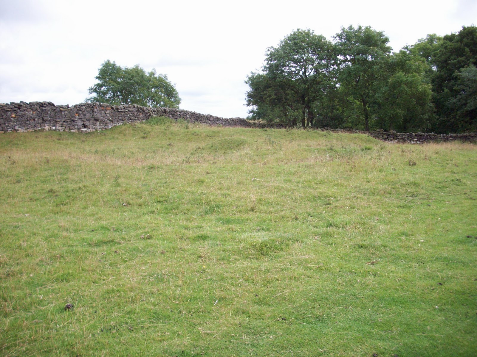
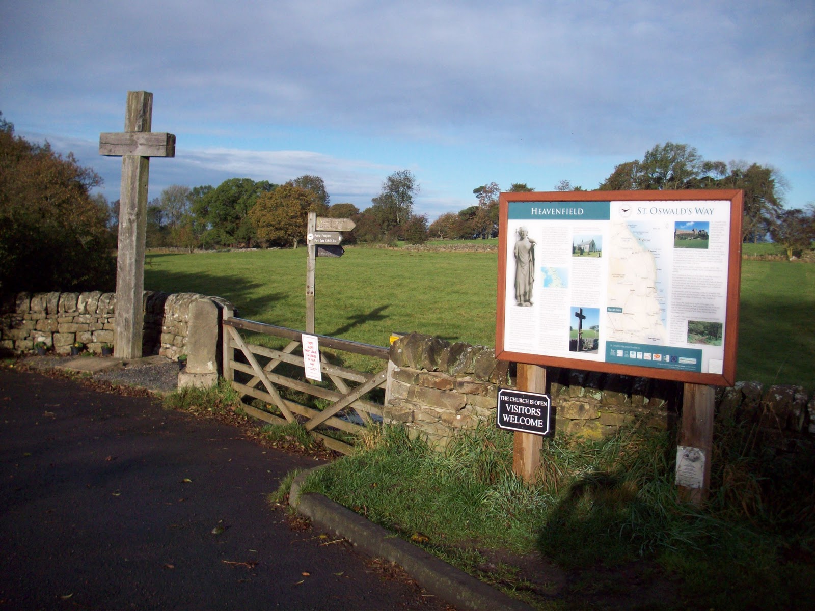
My first visit to the Trail in August was later than usual in the month. This was due to me being away on holiday in Suffolk. I dressed for fine weather and left my gaiters and waterproof trousers at home. At Heavenfield, the early morning mist shrouded St. Oswald's Church and the ground was damp with the dew.

Fingerpost at Stanley Plantation - 10/08/2012.

It did not take long before my walking boots and bottom of my trousers were wet. I was regretting leaving my gaiters at home. Heavenfield's grass had been cut for hay, it was waiting for some sun, the recent wet weather has made this very late this year.

On the three and a quarter mile walk east, I stopped at all of the gates, stiles and fingerposts to cut back the grass and vegetation, the mist did not burn off until mid morning, at eleven oclock I met my first walkers of the day, as I was cutting back at the last stile of my section. One of the walkers was an American who was on the fourth day of his walk travelling east and the other two were Dutch who had just started their walk at Corbridge today.

Fingerpost at Stanley Plantation - 10/08/2012.
I had completed all of the maintenance tasks on the eastward leg of my walk in just over three hours. After packing up all of my gear into my rucksack, I set off back to Heavenfield and got back to my car in just over one hour of walking. By the time I reached my car, the sky was a brilliant blue and the sun was shining brightly.

The Trail needs a long period of this kind of weather to recover from the rain of recent months. Walkers get such a tremendous experience on the Trail, it does make all the difference when they get to do the walk in fine weather.
On the return leg looking west- 10/08/2012.
Weather for the week of my next visit was to turn to heavy rain and strong winds, this was to be for the end of the week, so I made my second visit in August when there was some sun and no rain. Looking back at previous years walking seasons, the numbers of walkers I have met this year whilst out on the Trail is considerably down. The wet weather of the last few months seems to have put walkers off from coming to Northumberland.

Walking west - 14/08/2012.
Whilst out today I did not meet any walkers completing the full Trail. The only people I saw were some locals out with their dogs. My visit to my section today was more of a gentle walk, compared with some of my walks of recent weeks. Last week, I spent a great deal of time cutting back grass and vegetation. There was no need for me to do any work beside and underneath the gates, stiles and fingerposts.

Going into Heavenfield - 14/08/2012.
 My early start saw me complete the round trip to Heavenfield lay by, in just over three hours. My only task today was to pick up some litter dropped along the Trail. I also had to get down into the bottom of the Wall ditch and vallum to remove some fertiliser bags that had been blown there by the wind. Today's visit was to be my twenty eighth walk of the section. During that time, I have continued to document 2012 on Hadrian's Wall Path National Trail using my camera.

Beside the Wall vallum - 14/08/2012.
 With the weather forecasters predicting heavy rain for the Bank Holiday weekend, I collected all of my gear together and got out on the Trail again trying to complete my walk and get the photographs without getting wet. It took me just under three hours to do the walk of my section. Although the ground was still wet and waterlogged in places, I did not have to put on my waterproof gear.

August view looking east - 24/08/2012.
 The sky remained grey and threatening, at some points along the Trail, I felt some drops of rain. I only met two walkers today when I was out. They were walking the Trail from Carlisle to Heddon on the Wall. Compared with previous years, there seems to a large reduction in the amount of walkers this season. The weather seems to have put off walkers this year.

Walking west in Stanley Plantation - 24/08/2012.
Over the last few weeks I have had to cut back the grass and vegetation around gates and stiles. The warm wet weather is still making the grass grow and in some places, some time was spent tidying up. I even had to do a spot of dry stone walling near to St. Oswald's Tea Room, cows must have been in the field and dislodged the stones from the base of the wall, beside one of the gates.

Walking west back to Heavenfield - 24/08/2012.
 Saturday 13th March 2010, saw Hadrian's Wall Path National Trail illuminated with 500 points of light from gas burners and flares. In total, 1200 illuminators were stationed at 250 metre intervals along the 84 mile route. The 'line of light' started at Wallsend and travelled across the country until it reached Bowness on Solway.

The progress of the 'line of light' was filmed using a helicopter, the first beacon was lit at 5.45 p.m. and the last at just after 7.00 p.m.

Illuminating Hadrian's Wall 2010 - Steel Rigg, Northumberland.
Two years later, Hadrian's Wall will been seen in a whole new light on the 31st August and 1st September. Connecting Light arrives in Hadrian's Wall Country as part of the London 2012 Festival. The Wall will be illuminated by 400 - 6ft diameter weather balloons.

It is an interactive installation that will allow you to send messages in light over 73 miles. There are nine dramatic viewing locations where there will be help to get you involved.
For full location details go to www.hadrians-wall.org and click on 2012 Events.

You can watch it at home or on the move at  www.connectinglight.info