Walking East
This section of Hadrian's Wall National Trail covers a distance of three and a quarter miles (5.2 kilometres). It passes through Northumbrian grassland, with magnificent views to both the North and South.
 |
| Heavenfield Layby. |
The Military Road (B6318) will be on your right as you walk through Heavenfield. The path runs through grassland and in the middle of the field on your left you will see St.Oswald’s Church.
 |
| St. Oswald's Church, Heavenfield. |
 |
| Heavenfield. |
Walking through the grassland you will come to a gate, passing through the gate, you will come to St. Oswald's Hill Head Farm on your left. The Tea Room has been converted into
a holiday cottage.
 |
| St. Oswald's Hill Head Farm |
Passing the Farm, the trail continues to run parallel with the B6318 Military Road. As there are no standing remains of the Wall in this section, you should imagine the road as being the Wall. Most of the remains are buried under the line of the road.
 |
| Trail at St. Oswald's Hill Head Farm |
The trail continues, passing through two gates, the well defined Wall ditch can be seen on your left, filled with gorse bushes. Work has been carried out by the Trail Ranger to remove some of the gorse bushes at this point.
 |
| Wall ditch and trail. |
At the top of this slight incline, there is a sharp left hand bend and a short uphill section to another gate.
 |
| Gate to next part of trail. |
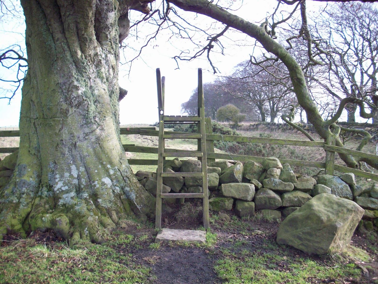
Walking again in grassland, the Wall ditch and road will now be on your right. This part of the trail follows a slight incline to the top of the field where you have to negotiate a stile underneath the boughs of a tree.
 |
| Stile. |
The trail then follows level ground with the well defined section of Wall North ditch on your right.
 |
| Wall ditch, a well defined feature. |
Reaching the highest point in this part of the trail, allows uninterrupted views of the countryside to the north and south. You now follow the path downhill to another stile.
 |
| Stile to next part of trail. |
On your walk in this area of grassland you will see the well defined Wall ditch on your right.
 |
| Wall ditch. |
The trail continues on a gradual uphill slope as you make your way to the steps to the B6318 Military Road Crossing.
 |
| Steps up to road crossing. |
Care should be taken when crossing the B6318 Military Road. Vehicles travel very fast on the straight road.
After crossing the road you will follow the trail in grassland.
 |
| South side of road crossing. |
Once in the grassland on your left, you will see the bumps and mounds in the ground which mark the site of Milecastle 24 - Ordnance Survey: NY960 692.
 |
Site of Milecastle 24.
|
Passing Milecastle 24, it is a short walk to the next stile.
 |
| Stile beside site of Milecastle 24. |
The trail carries on through rough pasture and levels out through an area of gorse bushes. The Vallum will be on your right hand side.
 |
| Trail. |
At the end of this part of the trail, there are two stiles to negotiate the road crossing. Before crossing the road on your left there is evidence of stone quarrying.
 |
| Evidence of stone quarrying. |
 |
| Road Crossing. |
Once over the second stile, the Military Road Plantation will be on your right and the trail follows a slight incline on stone flags for part of the way, the path then reverts to grass.
 |
| Trail. |
 |
| Trail. |
At the end of this part of the trail there are two gateways to pass through before you enter Stanley Plantation. The gates were stolen sometime ago.
 |
| Gateways and Drove Road. |
Once in Stanley Plantation, the trail rises steadily through the trees and vegetation. Much of the plantation has now been felled.
 |
| Section of Trail passing through Stanley Plantation. |
The trail continues to go uphill, until you reach the highest point of the trail in this area. The highest point of the section is 268 metres above sea level – Ordnance Survey: NY973 690.
 |
| Triangulation Point. |
Past the triangulation point, the trails levels out and you will come to the gate that will take you out of Stanley Plantation and back into grassland.
 |
| Gate out of Stanley Plantation. |
Once into the grassland, on your left is the site of Milecastle 23 - Ordnance Survey: NY975 689. Its position can only be seen as a series of mounds and hollows in the grassland.
 |
| Site of Milecastle 23. |
The trail now follows level ground, the Vallum is on your right filled with gorse bushes.
 |
| Trail and Vallum. |
 |
| Trail and Vallum. |
The Trail now continues downhill all of the way to Portgate. Passing through grassland you have to negotiate another stile. This stile and field fence has now been removed.
 |
| Stile and field fence has now been removed. |
At the bottom of the field you have to cross a narrow road using the two stiles or newly installed gate:
 |
| Stile at road crossing. |
Nearing the end of this section, the trail continues downhill through grassland, with the well defined Vallum on your right hand side.
 |
| View towards Portgate. |
Another stile takes you into the last stretch of trail before the Car Park at the Errington Arms.
 |
| Stile. |
The end of the Section is when you negotiate the final stile and arrive at Portgate: Car Park of the Errington Arms.
 |
| Portgate: Car Park at Errington Arms. |
The walk on this section of Hadrian's Wall National Trail, has allowed you to see some well preserved and defined features of the World Heritage Site e.g. Wall Ditch and Vallum. Although there are no visible sections of the Wall here, the Trail passes through some magnificent countryside.


Recently completed the walk from Wall to Portgate via Heavenfield.Good information here,Ray.
ReplyDelete