Search This Blog

Tuesday, 8 November 2011

Walk of Section: 7th November 2011

The 2011 season on Hadrian's Wall Path National Trail has finished, as a Volunteer Ranger I try to get out all year round, depending on the weather. The weather forecast was favourable and getting all my gear together the night before , I was prepared to walk my section on the 7th November.

The forecast was for a hard frost, sunny spells then turning cloudy. It was to be the first hard frost we have experienced. I try to get out early and it was about 8.15 am when I parked in the layby at Heavenfield. The temperature was -2oC.

Starting point of my walk of section.
This was the first picture I took. Making sure I had everything required I got onto the Trail and saw my first job of the day. The moles in the field had been busy and their molehills were dotted along the Trail at various points. It was hard work to rake them out as they were frozen solid.

Gate close to St. Oswald's Hill Head Farm.
Although still early, the sun was starting to break through and it had all the ingredients of a good morning.

Footprints in the frost on the Trail.
Looking back towards St. Oswald's Hill Head Farm, I saw my footprints in the frost. At this point the Wall ditch is on the right of the photograph, underneath the gorse bushes.

View looking north.
The next valley was shrouded in mist as I continued walking east towards Portgate.

Wall ditch.
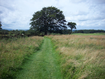
The above image is one of my favourite points on my section. The tree is a good place to stop for lunch. I would not be stopping long today!

B6318 Military Road crossing.
I reached the middle of the outward leg of my walk at about 9.00 am. The sun was shining and the frost was starting to disappear in places.

Frost on stile
Near to Portgate looking west.
I reached Portgate about 10.00 a.m. and after a quick drink and check for litter around the last stile on my section set off on my return journey walking west. The sun was brilliant and areas not in the shade were starting to be free from the earlier frost.

The "dividing line"
Walking back I came across the above.  The area in the shade was still covered in frost!

Back at the halfway point.
Reaching the halfway point the next valley was still covered with mist.

View of Trail looking west
I was nearing the end of my walk pf the section. The frost had virtually all gone from the ground and it was unusal to spot some yellow flowers on the gorse bushes. The second flowering of the year!

Yellow flowers
It was not long after taking this photograph that I reached the layby at Heavenfield. The weather forecast was correct and the walk enabled me to monitor the condition of the Trail after the 2011 walking season.

Tuesday, 11 October 2011

Walk of Section: 11th October 2011

 This was to be my final official walk and monitoring visit for the 2011 season. The season will finish at the end of October. Weather permitting, I will continue to visit during the winter months and ensure all is well for the new season in 2012.

The weather forecast for today indicated rain and sunny periods. I started my walk of the section at Heavenfield at about 8.30 a.m. and was on my return journey when it started to rain at about 11.00 a.m. It was quite a heavy shower so I had to resort to my waterproofs.

Vegetation is starting to die off, so I did not spend as much time as usual cutting back along the Trail and under the gates and stiles.

The rain of the last few months has made the Trail waterlogged and in places very muddy. It is good that the season is rapidly coming to an end, so that it can get a rest from the thousands of walkers feet.

Molehills are starting to appear along the path again. These will need to be monitored and raked over in the next few months.

In total, I only met and talked to six walkers completing the full Trail today.

The major problems found today were: stones removed from a wall and a flooded section of the Trail.

The following photographs were taken as I was out on the section:

View of trail looking west.

Victim to the recent high winds!

View towards Stanley Plantation.

Trail in Stanley Plantation.

Problem area.

Near to site of Milecastle 24.

View of Trail looking west near to Heavenfield.

Vegetation starting to die off.

Monday, 26 September 2011

Hadrian's Wall Path National Trail - The 2011 season coming an end!

The 2011 walking season on Hadrian's Wall Path National Trail is rapidly coming to an end. The six month season will see approximately 10000 walkers completing the full Trail, coast to coast. As one of the many National Trail Volunteer Rangers, I have been out at least once a month to monitor the Trail and the sensitive archaeology, on my section of Hadrian's Wall.

Hadrian's Wall Path National Trail - Heavenfield.
My section of the Trail covers a distance of three and a quarter miles and begins at the Errington Arms, Stagshaw roundabout and finishes at Heavenfield. On a monitoring visit, I will walk this section in both an easterly and westerly direction. The six and a half miles will take me approximately three to four hours, depending on how much maintenance work needs to be carried out, on that day and on how many walkers I see and talk to.

My first monitoring walk of the new season was in early May and the Trail was found to be in a reasonable condition considering the previous bad winter we had experienced.

Start of season, near to Heavenfield looking west- 10/05/2011.
On a fine day, the north and south views from the Trail are magnificent. Depending on the time and day of the week, I sometimes find I have the path all to myself. The amount of work we have to do depends on the time of year and weather. We have to spend sometime cutting back vegetation, nettles and brambles from beside the path and in and around the gates and stiles.

Near to the site of Milecastle 24, looking west - 06/06/2011.
The good weather in the early part of the season enabled the Trail to withstand the pounding from the large number of walkers. It also gave the grass and other vegetation ideal conditions in which to grow. The Trail needed some attention by the two full time lengthsmen to keep it looking at its best.

Newly mown path in Heavenfield - 01/07/2011.
Trail beside the Vallum, looking west - 01/07/2011.

Wet weather is a major problem in my section of the Trail. Dips and hollows can easily become waterlogged and as part of it passes through the wooded area of Stanley Plantation, the path can become very muddy. The wet weather of July and August was to give us all of the conditions mentioned above.

Stanley Plantation - 11/07/2011.
Wet weather problems on the Trail - 19/08/2011.

With the B6318 Military Road running parallel to my section of the Trail, there is always fast moving traffic near to walkers at various points. A  van recently, left the road, crashed through the dry stone wall and finished up on the path! Police had to divert walkers aound the site of the accident. It was very lucky that there were no walkers at the time of the accident.

Work also had to be carried out on a field drain to stop the path being flooded. At one point water was very deep and it was spread out over a wide area.

Flooded path - 05/09/2011.
As we move into Autumn, the Trail will be start to become quieter again, vegetation growth will be slower, but I  will continue to monitor the Trail throughout the winter months, weather permitting!

View east towards Stanley Plantation - 21/09/2011.
Our work on the trail is varied and interesting, The Volunteer Rangers across the Hadrian's Wall corridor spend a great deal of time keeping the path litter free and ensure it is clear and unobstructed for all of the walkers and visitors to the World Heritage Site. The most important feature of our work is monitoring the sensitive archaeology and reporting any problems. It may be a short season, but the work continues all of the year.

Thursday, 22 September 2011

Walk of section - 22nd September 2011

Took advantage of the dry and sunny weather of late September to squeeze in another walk of the section. The rain of the last three months still continues to cause problems on the Trail. The dips and hollows are still waterlogged with standing water in places. 

Plastic matting has been laid by our two lengths men on the most muddiest areas of my section. On my walk today I cut back the vegetation around all of the stiles and gates, I also cut back any brambles and nettles encroaching on the path. Molehills are also starting to appear on some grassed areas.

I met 24 walkers on the Trail today, 22 were completing the full Hadrian's Wall Path National Trail, the other two were day walkers out with their dog.

Whilst in the wooded area of Stanley Plantation I found the path blocked by a large branch. Moving it was quite difficult, as it was down in the narrowest section of the Trail. 

The following photographs were taken as I walked the six and a half mile return journey of my section:

Approaching Stanley Plantation walking west.

Beside Military Road Plantation.

Beside the Military Road Crossing looking west.

View of Trail looking west to Heavenfield

One of the problem areas on the Trail.

St. Oswald's Church at Heavenfield.


Monday, 5 September 2011

Walk of section: 5th September 2011

With the end of the season nearly upon us, it was time for another monthly monitoring report of my section. The weather forecast predicted sunshine and showers for this morning. I was lucky to complete the six and a half mile round trip without the need of my waterproofs.

I began my walk at Heavenfield in bright sunshine and reached Port gate at about 10.15 a.m. On the way, I cut back the vegetation around all of the gates and stiles on the Trail, picked up a wide variety of litter, cut back brambles and nettles near to the Trail and replaced one missing Acorn way marker which had been removed from a stile.

On the first leg my walk I met no walkers. it was only on my return leg that I met four people, who were completing the full Trail.

The recent wet weather has not helped the Trail as it was waterlogged, flooded and very muddy in places.

The following photographs were taken as I completed the walk of my section:

Example of one of the problem areas.

Walking East towards Portgate.

Trail looking West.

Trail looking West towards Stanley Plantation.

Flooded section of Trail.

Walking West towards Heavenfield.

Looking East.

Gate into Heavenfield, walking West.

Trail in Heavenfield, walking West.

Sunday, 4 September 2011

Hadrian's Wall Path National Trail - 2011 Season

Hadrian's Wall is a remarkable monument to nearly four hundred years of Roman rule in Britain. It is now a UNESCO World Heritage Site and a Scheduled Ancient Monument. In 2003, Hadrian's Wall Path National Trail was opened and the well trodden path is also a Scheduled Ancient Monument. The walking season begins in May and finishes in October, approximately 10,000 walkers will follow the route across the country.

The route will take the walker through urban landscape and magnificent countryside, and will provide many opportunities to see some wonderful sites.


Sycamore Gap - An iconic image associated with the Trail.

The 2011 season is rapidly coming to a close. Over the year as a National Trail Volunteer Ranger, I have been looking after and monitoring the Trail's condition, on a three and a quarter mile section. The season has seen periods of dry weather and prolonged periods of rain. July and August has been particulary wet this year!


Waterlogged path after heavy rain - mid August.

You are never certain of what you are going to find when out on your section of the Trail! Take this season for example. I have had to report dead sheep, remove stones and rubble from the path after a van crashed through a dry stone wall and report many waterlogged stretches.


The Trail started off as usual in an excellent condition, most off my visits over the season were completed without the need of full waterproofs. This was not to be the case for some of the walkers I have talked to. With the full walk taking more than five days plus, they were bound to get caught in some of the bad weather we have experienced.


Trail beside the Wall Vallum looking West

Friday, 19 August 2011

Walk of Section - 19th August 2011

Today was to be my first visit to my section of the trail in August. Starting at Heavenfield the ground beside the gate was very muddy and waterlogged. It was to be a familiar site along the route, due to the recent rain especially over last night.

The dips in the trail were waterlogged and it will need a long period of dry weather for them to dry up. Many of the fields that the trail passes through have been cut and collected for hay. 

As usual, my tasks along the section were: litter picking, cutting back vegetation around the numerous gates and stiles, cutting back nettles/brambles/bracken which encroaches on the trail and monitoring path condition and archaeology.

At the mid point of my section of the trail, walkers come to an area laid with stone flags, this area was flooded and water was running from a drain along side the B6318 Military Road.

Flooded section of Trail
Not far from this point you enter Stanley Plantation,the path was very muddy underfoot and some areas waterlogged. At some points, you could not take a drier route, It is the first time this season that I have seen the trail in such a poor condition. The rains of July and August have really left their mark!

I try to complete all of my work on the outward leg of the section. Reaching The Errington Arms at about 11.30, with everything completed, I set off on the return leg and managed to take some of the folloiwng photographs. In total, I walk six and a half miles, and today I met 14 walkers completing the full 84 mile trail.

I will try to fit in another walk of my section before the end of August and monitor the problem waterlogged areas. We certainly could do with a dry spell of weather before the season finishes in October.

Looking East towards Portgate

Trail looking East

Trail looking West towards Stanley Plantation

Trail looking East

Vallum

Vallum

Trail looking East towards Military Road Crossing point

Trail looking West


Trail looking West

Wall ditch

Trail looking West towards Heavenfield