Portgate to Heavenfield is a small part of Hadrian's Wall National Trail, a World Heritage site, it covers a distance of three and a quarter miles in the countryside of Northumberland. http://www.nationaltrail.co.uk/hadrianswall/
In this posting, I intend to describe the historical aspects of Hadrian's Wall in this part of the trail, and show pictures of the section as it is today.
 |
| Part of the Trail, looking West towards Heavenfield. |
The trail can be found running parallel to the B6318 Military Road to the north of Corbridge. Although there are no remaining milecastles, turrets or the Wall itself to be seen above ground level, you can see good examples of parts of the Vallum (South side of Wall) and the Ditch (North side of Wall). The Roman Wall in this section lies directly underneath the B6318 Military Road.
Every season, there are approximately 10,000 walkers who will complete the trail in full or in sections. Various publications and maps are available which identifies the route to follow. For the walker on the trail, all they have to do is look out for the distinctive white Acorn sign and yellow and green way markers. These signs can be found on stiles, gates and finger posts along the route.
 |
| Example of Acorn sign and way marker indicating route to follow. |
 |
| Example of a Finger post at Heavenfield lay by. |
Hadrian's Wall was 80 Roman miles (73.5 statute miles or 117 kilometres) long.
In Roman times, the unit of long distance mille passuum (literally "a thousand paces" in Latin, with one pace being equal to two steps) was first used by the Romans and denoted a distance of 1,000 paces or 5,000 Roman feet, and is estimated to correspond to about 1,479 metres (1,617 yards). This unit is now known as the Roman mile This unit spread throughout the Roman empire, often with modifications to fit local systems of measurement.
In total, there would have been three milecastles and seven turrets in this section of Hadrian's Wall:
Turret 22A (Under B6318 Military Road)
Turret 22B (Under B6318 Military Road)
Milecastle 23 (Visible as a platform) Ordnance Survey NY 975 689
Turret 23A (Under B6318 Military Road)
Turret 23B (Under B6318 Military Road)
Milecastle 24 (Excavation/robber trenches) Ordnance Survey NY 960 692
Turret 24A (Under B6318 Military Road)
Turret 24B (No visible trace)
Milecastle 25 (Visible as a low platform) Not on the Trail
Turret 25A (Could be under B6318 Military Road)
Start of this Section (walking in a westerly direction).
 |
| The Errington Arms Public House, Stagshaw, Corbridge. |
 |
| Start of the Section - The Errington Arms Car Park. |
The Portgate was a fortfied gateway, constructed as part of the Wall (Dere Street preceded Hadrian's Wall by around 50 years). It was built to control the traffic along Dere Street ( Now the A68 Road) as it passed through Hadrian's Wall. Its remains exist beneath the old B6318 Military Road to the south-west of the Stagshaw Roundabout (the B6318 was diverted slightly for the construction of the Stagshaw Roundabout, leaving two short sections of the existing road unlinked - the remains of the Portgate are buried beneath the western section).
 |
| Stagshaw Roundabout looking North. |
 |
| How the Portgate may have looked? Reconstruction at Arbeia Fort. |
Vallum.
 |
| Earthworks associated with Hadrian's Wall. |
The Vallum is the huge earthwork, that ran from coast to coast on the South side of Wall. The distance of the Vallum from the Wall varies along its length.
The total width of the earthwork was 36 metres (100 feet).
It consisted of a North mound and South mound. The Vallum which was 6m wide and 3m deep, with a flat bottom. The North and South mound were 6m wide and 2m high.
 |
| View showing North mound in foreground, Vallum and the South mound in front of the field fence line. |


Milecastle 23 Ordnance Survey Grid Reference: NY 975 689.
The site of Milecastle 23 is to be found in a field before the trail passes into Stanley Plantation. Located in the 1930 excavations, it was found to have side walls which are ten feet thick and is probably of the long axis-type of construction. Today it is only visible as a platform in the pasture.
 |
| Site of Milecastle 23 - Ordnance Survey Reference: NY 975 689. |
 |
| Site of Milecastle 23 - Ordnance Survey Reference: NY 975 689. |
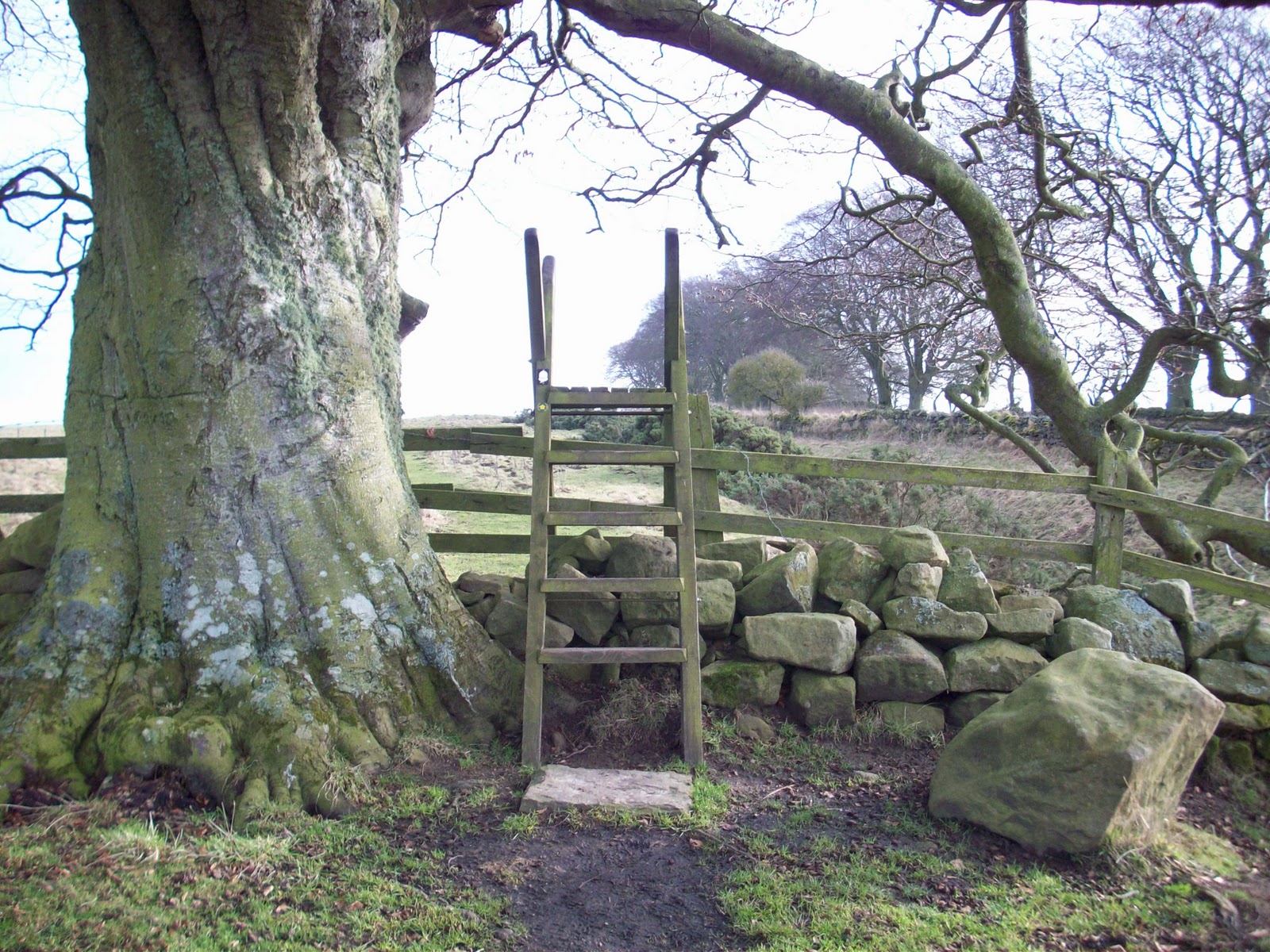
Stanley Plantation was a mature conifer plantation. Much of the plantation has now been felled. The trail through it runs parallel to the busy B6318 Military Road.
 |
| Gate into Stanley Plantation |
The path through this area can become very wet and muddy in places, during the walking season. A great deal of work has been carried out by the National Trail Ranger on some of the problem areas.
 |
| Trail approaching remaining section of standing trees in Stanley Plantation |
You will reach the highest point on the Portgate to Heavenfield section, whilst walking through Stanley Plantation. A Triangulation pillar is located on the verge of the Military Road at 268 metres above sea level. During the Summer months, it may be hidden from view by vegetation.
Ordnance Survey Grid Reference for the pillar is NY 973 690.

Triangulation pillar beside the trail in Stanley Plantation.
The views are stunning, more can been seen due to the tree felling, there are places where you can look over the wall and see the wonderful views of the countryside to the North.
 |
| The view looking North from Stanley Plantation. |
 |
| Work carried out on a wet and muddy section of Trail |
Military Road Plantation.
This thinned out plantation runs parallel with the B6318, Military Road. This part of the trail has been laid in places with a flagstone walkway. Places where this does not exist can become very muddy. Lots of work has also been carried out on this part of the Trail by the Maintenance Ranger.
 |
| Trail passing beside Military Road Plantation, looking West. |
Evidence of stone quarrying.
On the trail before Milecastle 24, you can see evidence of stone quarrying in the fields beside the Vallum.
 |
| Quarry beside the trail Ordnance Survey Reference: NY 964 692. |
Milecastle 24 Ordnance Survey Grid Reference: NY 960 692.
The site of Milecastle 24 is also found in a field, just before the trail takes you across the busy B6318 Military Road. It can only be seen as a series of excavation or robber trenches. It was identified in 1930, as of the long axis-type of Milecastle, its walls being ten feet thick.
 |
| Site of Milecastle 24 - Ordnance Survey Reference: NY 960 692 |
 |
| Site of Milecastle 24 - Ordnance Survey Reference: NY 960 692 |
Milecastle 25 Ordnance Survey Grid Reference: NY 947 694.
This milecastle of broad wall construction, is now on private land, it is not on part of the Trail. Part of it now lies under the B6318 Military Road and the rest can be seen as a low platform in the pasture.
Turrets.
In total along Hadrian's Wall there were 158 turrets. These were built on either side of a Milecastle, located about one-third of a Roman mile apart (500m or 540 yards).
No above ground structure can be seen relating to the following seven turrets in Section 7 of the trail: Turrets 22A, 22B, 23A, 23B, 24A, 24B and 25A. The majority of them are under the B6318 Military Road.
B6318 Military Road Crossing Point.
Up to this point, the trail would have been on the South side of Hadrian's Wall. Walkers will have to cross the road and then follow the trail on what would have been on the North side of the Wall.
It is easier to visualise, if you think of the road as the Wall, (the majority of it in this section is actually underneath the road.
Care should be taken when crossing this very busy road.
 |
| South Stile to B6318 road crossing. |
 |
| B6318 Military Road looking West. |
 |
| North stile after road crossing to take walkers back onto trail. |
The Military Road or Wade's Road is so named because it was built by order of General Wade shortly after the 1745 Jacobite rising to provide a direct and easy passage for troops between Newcastle and Carlisle. Much of the road was built on top of the Wall.
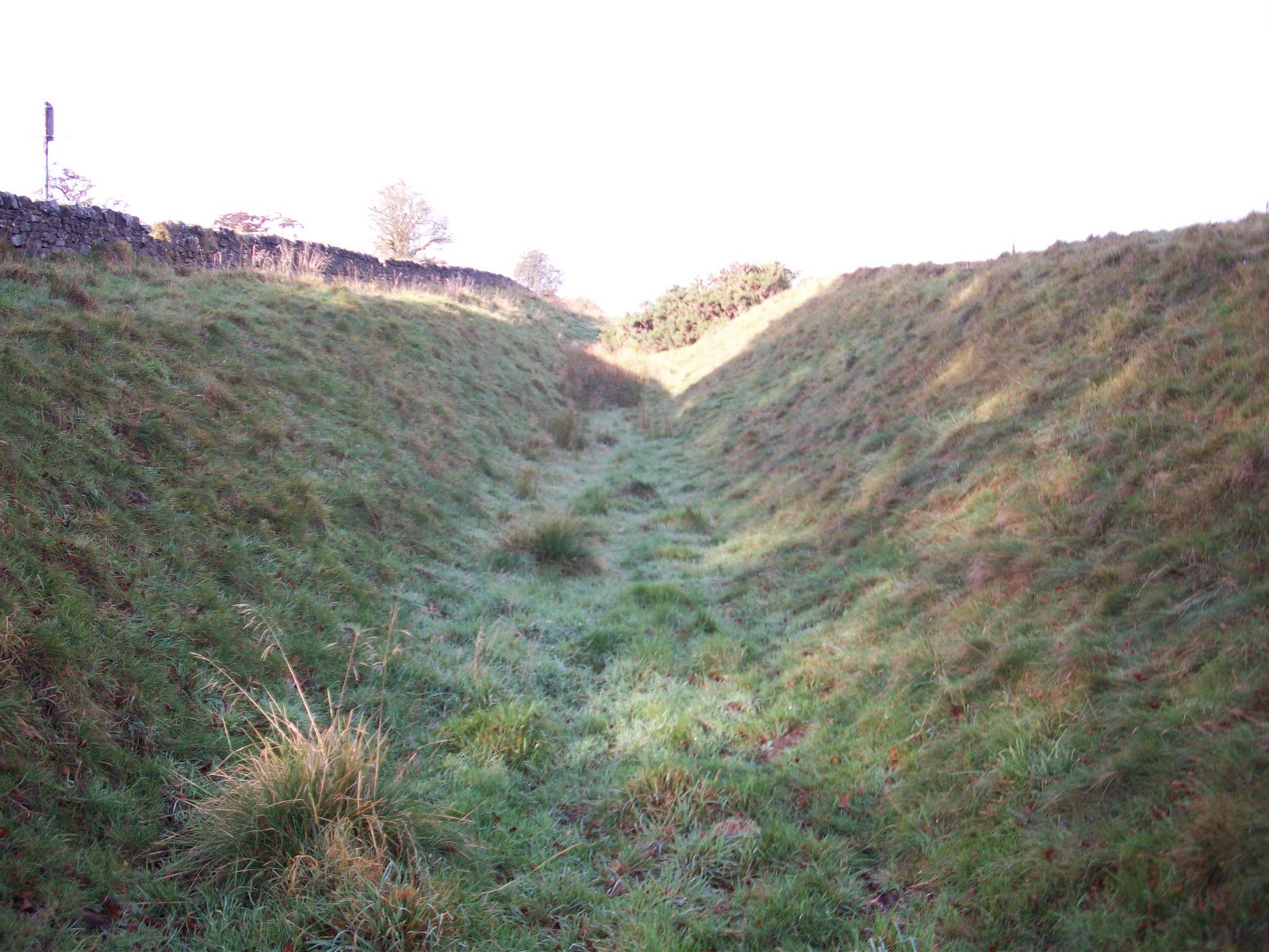
Ditch.
Throughout the whole of its length, the Wall was accompanied on the Northern side by a ditch. It increased the comparative height of the Wall and greatly added to its strength as a barrier. Even in the places where the Wall has disappeared, the ditch remains.
 |
| Ditch Construction. |
North side of Wall.
Consisting of counterscarp and berm.
Ditch 3m deep.
Further views of the Ditch on the trail, going towards St. Oswald's Hill Head Head Farm and Heavenfield. |
| Section of ditch on trail, looking west towards Heavenfield. |


https://www.stoswaldsfarm.co.uk
St. Oswald’s Hill Head Farm,
Nr. Wall
Hexham, NE46 4HB
Holiday let contacts:
Mob: 07944 503536
 |
| Holiday Cottage at St.Oswald's Hill Head Farm |
 |
| Front of holiday cottage at St. Oswald's Hill Head Farm |
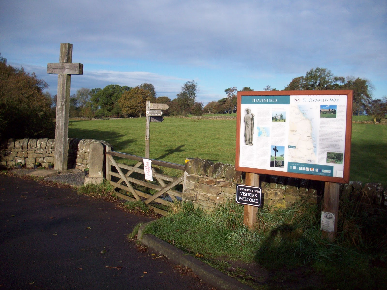
Battle of Heavenfield.
 |
| Entrance to Heavenfield, looking West. |
 |
| Trail passing through Heavenfield, looking West. |
 |
| Heavenfield Lay by looking North to St. Oswald's Church. |
The Welsh army under King Cadwallon and the Northumbrian army under Oswald met in battle beside the still standing Hadrian's Wall.
The Welsh were defeated, and Oswald was established as a Christian King of Northumbria.
 |
| St. Oswald's Church, Heavenfield. |
The present building is probably the third on the site of what is believed to be the location where King Oswald (604 -642) raised a large wooden cross before the Battle of Heavenfield (AD 635).
Foundations of a Saxon church were discovered by dowsing in the 1950s, this being succeeded by a mediaeval church replaced in 1817 with the present building.
Heavenfield Lay by, the end of this section of the trail.
Here, at Heavenfield, Oswald and his army were well situated to meet the Welsh, who were advancing up the old Roman road called Dere Street, which crossed the Tyne at Corbridge.
Oswald prepared for the conflict by placing a cross in the centre of the Battlefield and led his men into prayer for victory. The wooden cross in the lay by commemorates the victory.
 |
| Wooden Cross - End of section, Heavenfield Lay by. |